News
Stay tuned for the latest news of events, product release, features, updates, tips and more.


Date: 2021-05-07 6632 Tag: Company
We are pleased to announce that TcpMDT is now compatible with the latest versions of GstarCAD, civil designers and professionals will gain an advantage by combining the latest technology of GstarCAD and TcpMDT.

MDT, used by thousands of users around the world, it is a complete solution for the development of all types of topographic projects, being possible to model the land of a plot to elaborate projects of roads or urbanizations. It is very easy to learn, and you can choose between permanent or annual licenses.
If you want to add to your client portfolio construction companies, public administrations, universities, transport or engineering companies, now you have the opportunity to offer our highly competitive solutions.
About MDT:
Standard version
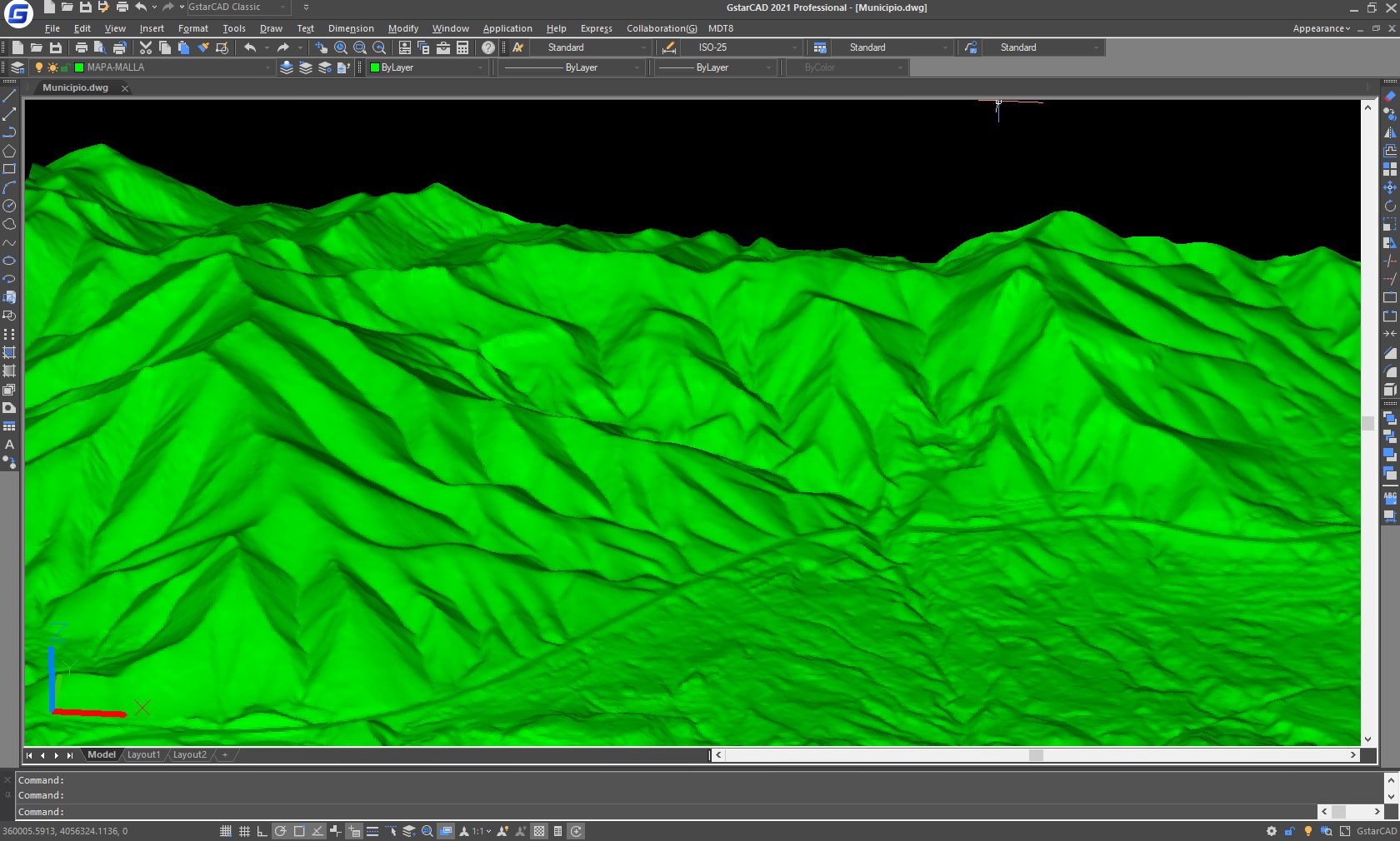
It allows you to model a terrain using points measured by any total station or GNSS receiver, importing files or connecting to web services. It provides options for generation of contour lines, drawing of profiles and cross-sections, calculation of volumes, visualization of terrain in 3D, slope maps, import and export GIS files, etc. It also has functions for working with plots and multiple additional utilities.
Professional version
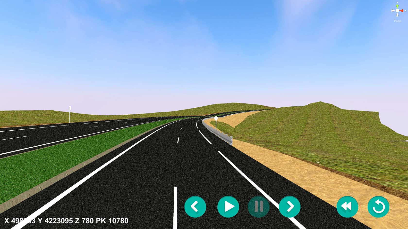
It includes all features of standard version and provides tools for designing horizontal and vertical alignments, drawing the project templates, area and volume reports, setting-out, virtual tour, measurements and quotations, water, sewerage and rainwater networks, etc. This software is suitable for all kind of surveying projects for roads, urbanizations, quarries... It is easily integrated into OpenBIM workflows, through exchange of IFC and LandXML files.
Surveying module
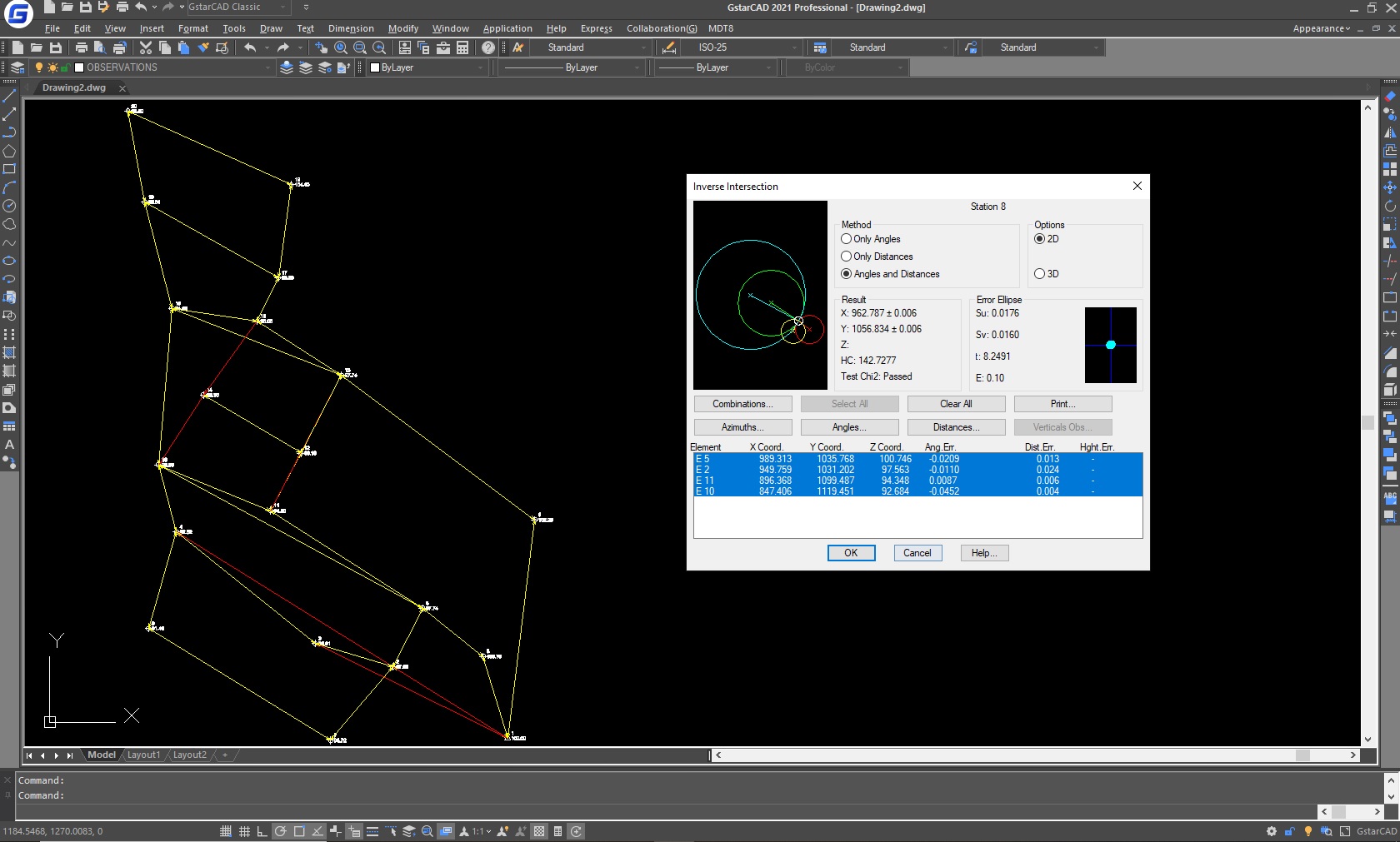
It is very useful for processing total station observations, calculating point coordinates and compensating traverses and networks. It also allows you to perform coordinate transformations and include the EPSG database with global coverage of reference systems, organized by countries.
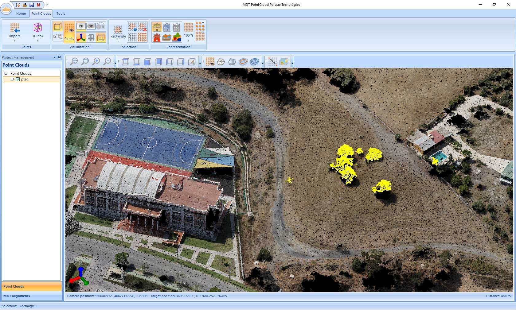
Point cloud module
It allows the user to view and process point clouds captured by laser scanners, LiDAR technology, Mobile Mapping or photogrammetry applications. It can manage millions of points imported from files in common formats. It also generates profiles and cross-sections from a polyline or alignment, as well as digital models that can be easily exported to CAD.
Images module
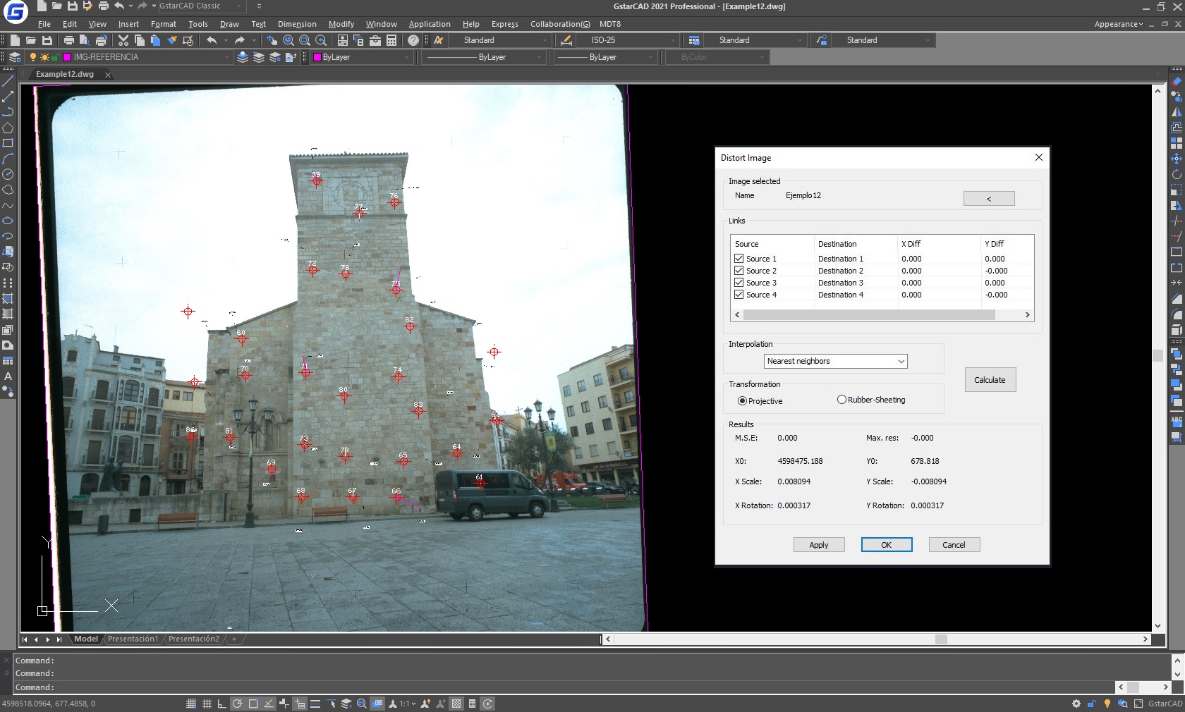
It is designed to work with digital images such as photographs, orthoimages and scanned maps in combination with vector drawings. It is very easy to georeference and distort images using control points, apply adjustment and conversion processes as well as joining and splitting images.
Try it for free
Download is available, please feel free to download and try https://www.gstarcad.net/application/tcpmdt?id=36
See TcpMDT for GstarCAD in action https://www.youtube.com/watch?v=QjtyeNnztiQ

2026-06-17

2026-04-02
2026-01-14

2025-11-27

2025-10-14
2025-07-10

2025-04-11

2025-04-03
