Application
We cooperate with local developers to provide industrial solutions for customers.


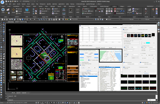
SDBOX for GstarCAD is a professional CAD add-on focused on creating complete topographic survey plans, from survey point import to the final print-ready PDF, with all intermediate drafting, mapping, geospatial, terrain, annotation, table, legend and title block steps organized in a clear and practical workflow.
It is built for land surveyors, civil engineers and CAD technicians who need practical tools for fast, accurate and consistent drawing production inside GstarCAD. The software is supported by extensive online documentation, including a manual portal, videos, workflow examples and step-by-step guides.
Main workflows and tools include:
1. Complete topographic and property plan drafting
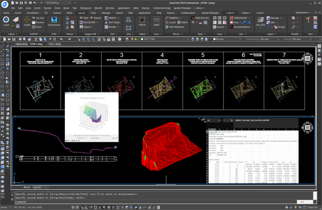
2. Terrain modeling, triangulation, contours, profiles, sections and volumes
3. Set-out drawings with coordinates and axis geometry
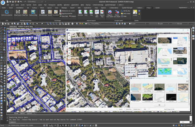
4. KML, SHP, DXF, JSON/GeoJSON and GeoTIFF geospatial workflows
5. Online map backgrounds, georeferenced images and spatial data integration
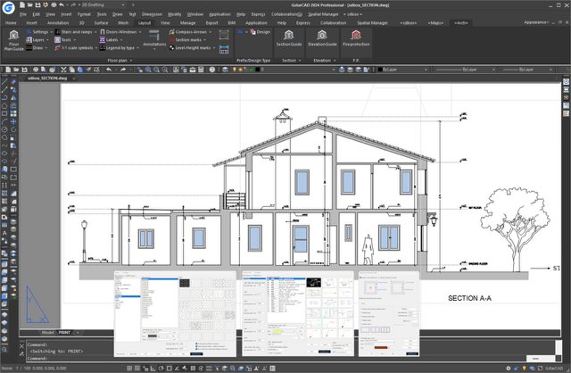
6. Building survey floor plans, sections and elevations
7. Scale-aware annotation, legends, tables, titles and one-click PDF output
8. Everyday CAD productivity tools for layers, texts, blocks, lines, hatches, images and dimensions